You see that's demonstrably false, right? As in, cannot possibly be true?
It clearly does not show shorter summer days and longer winter days at the tip of South Africa or South America. We know the times of sun rise and sun set at these places and your model doesn't show that at all.
On the latitude line that goes through the lower half of Australia, which also goes through the tip of Africa, it shows Australia spans about 2.5 lines of longitude.
When you measure 2.5 lines of longitude on that latitude line, using the scale directly below it, see picture. It measures 70-75 miles.
When you look at the distance using GPS it's over 2000 miles straight line.
Do you actually think it's even remotely possible that it's only 75 miles from Perth to Sidney?
And how do you explain that Gleason, the guy who created this map, said that the map was created by straightening the meridian lines of a globed map, and acknowledged the existence of two poles?
Oh, hey nigger, explain how a lunar eclipse happens.
Just a heads up - I'm already in a discussion thread with this guy where, he claims, we will properly review the 'overwhelming evidence' for FE. We should work together on this so we don't get this mess strung out all over the damn site.
I plan to use seismology as a basic easily-verifiable argument, and, when he claims all images are edited because NASA (etc), I was going to bring up those taken from amateur rocketry. I suppose your approach, tackling the basic physics of the flat model, is also a good approach, and also easy to digest for those who know 'enough' science to be dangerous, but are rather weak in the fundamentals of logic etc.
I already had to shoot down some dumb cube Earth map that he claimed predated modern Heliocentrism yesterday.
Just block me and the others if your not interested in the truth. Take the blue pill and go back to your daily distractions. Vote for zionist A over B. Cheer on the 146th riot that achieves nothing.
Meanwhile, those interested in the pursuit of truth will be curious. Science is never settled, question everything and "true wisdom is knowing that you know nothing."
This is the evidence? Converging angles, masked in Hasbara-tier MS-Paint work?
It's fine if it is - I just need to know what you are considering evidence for your viewpoint. We can't properly reason about a topic if the topic isn't defined.
The overwhelming evidence is in everything. From our vision to geometry to astronomy.
None of it fits a spherical model. If we lived on a ball the horizon would be geometric BELOW eye level, with 8 inches of curvature per mile squared, at no point would the ball beneath our feet ever meet at eye level in the distance.
Converging angles is how our eyeballs take in the information of the world around us.
If you considered it overwhelming, you would be able to list at least a few pieces offhand, no?
You've listed 3, and we can address them in order.
What about our vision suggests anything about the Earth's shape? What can you reason about geometrically that suggests a non-flat Earth? And finally, I am REALLY curious what you think may suggest a flat Earth, relating to astronomy.
[...] the horizon would be geometric BELOW eye level
But it is, and can be proven to fall away the further you go in elevation. I don't mean proven by experts either, you can prove this to yourself, much as the camera-zooming experiment you refuse to perform.
[...] with 8 inches of curvature per mile squared [...]
I love it when they trot this out, then forget that you will never be able to register this visually without instrumentation. Topographic variation is far higher over land, wave height is far higher over water, and, curiously, when you adjust for elevation (either through using a barometer, or, more accurately, radar against groundwater level), you actually prove the curvature. The Flat Earther's famously proved that themselves in front of Netflix' cameras in 2018. Ask if you can't find the cite on your own.
If you considered it overwhelming, you would be able to list at least a few pieces offhand, no?
Check my post history?
What can you reason about geometrically that suggests a non-flat Earth? And finally, I am REALLY curious what you think may suggest a flat Earth, relating to astronomy.
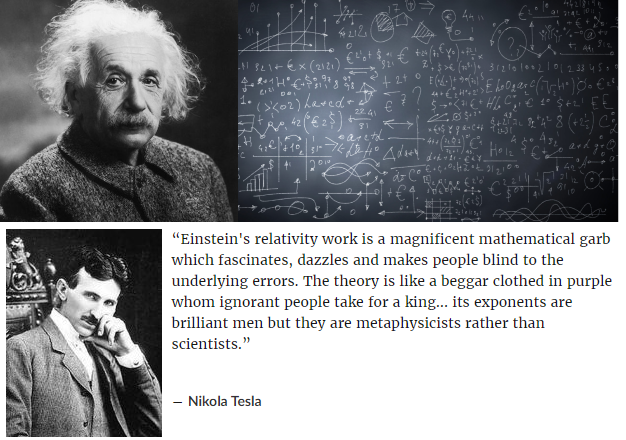
The Flat plane is Euclidean geometry, we have used euclidean geometry for thousands of years. Spherical geometry didn't exist until the jew Einstein came along and provided nonsensical theories to help postulate the globetard model.
And finally, I am REALLY curious what you think may suggest a flat Earth, relating to astronomy.
Astronomy only work with a flate plane and the sun, moon and stars circling around us at the north pole. The globetard theory with all of the supposed orbital patterns makes absolutely no sense at all.
But it is, and can be proven to fall away the further you go in elevation.
Incorrect, the horizon always rises to eye level even as high up as 120,000 ft in altitude. There isn't any single proof of the horizon dropping with elevation until you get to photoshopped images from NASA.
I love it when they trot this out, then forget that you will never be able to register this visually without instrumentation.
Well go ahead and showcase it with instrumentation, it's never been done. There is no 8 inches of curve per mile squared.
topographic variation is far higher over land
topography disproves the theory of a spherical earth, there can not be any changes in landmass to constitute a perfect sphere as NASA always showcases.
Curiously as well I've noticed you haven't provided a single link, image or pdf. You're making up claims without any receipts.
That's the nihilistic worldview the jew wants instilled in everyone.
We are at the centre of creation. Earth was created for us and the sun, moon and stars above us help us keep track of the time, navigate our plane and instills a sense of purpose.
[ + ] FreeinTX
[ - ] FreeinTX 1 point 10 monthsAug 6, 2024 06:54:46 ago (+1/-0)*
You see that's demonstrably false, right? As in, cannot possibly be true?
It clearly does not show shorter summer days and longer winter days at the tip of South Africa or South America. We know the times of sun rise and sun set at these places and your model doesn't show that at all.
https://files.catbox.moe/hv6ngp.png
Here is Australia on that map.
https://files.catbox.moe/7wpd2t.jpeg
And here is the scale on that map.
https://files.catbox.moe/zl3sqa.jpeg
On the latitude line that goes through the lower half of Australia, which also goes through the tip of Africa, it shows Australia spans about 2.5 lines of longitude.
When you measure 2.5 lines of longitude on that latitude line, using the scale directly below it, see picture. It measures 70-75 miles.
When you look at the distance using GPS it's over 2000 miles straight line.
Do you actually think it's even remotely possible that it's only 75 miles from Perth to Sidney?
And how do you explain that Gleason, the guy who created this map, said that the map was created by straightening the meridian lines of a globed map, and acknowledged the existence of two poles?
Oh, hey nigger, explain how a lunar eclipse happens.
[ + ] aleleopathic
[ - ] aleleopathic 0 points 10 monthsAug 6, 2024 19:45:28 ago (+0/-0)
I plan to use seismology as a basic easily-verifiable argument, and, when he claims all images are edited because NASA (etc), I was going to bring up those taken from amateur rocketry. I suppose your approach, tackling the basic physics of the flat model, is also a good approach, and also easy to digest for those who know 'enough' science to be dangerous, but are rather weak in the fundamentals of logic etc.
I already had to shoot down some dumb cube Earth map that he claimed predated modern Heliocentrism yesterday.
[ + ] NegaroNegaroNeeegaro
[ - ] NegaroNegaroNeeegaro 1 point 10 monthsAug 6, 2024 05:44:07 ago (+4/-3)
[ + ] GetFuckedCunt
[ - ] GetFuckedCunt [op] -3 points 10 monthsAug 6, 2024 05:50:00 ago (+2/-5)
Meanwhile, those interested in the pursuit of truth will be curious. Science is never settled, question everything and "true wisdom is knowing that you know nothing."
[ + ] NegaroNegaroNeeegaro
[ - ] NegaroNegaroNeeegaro 2 points 10 monthsAug 6, 2024 06:06:58 ago (+3/-1)
Why block when I can freely say it's fucking stupid as fuck. Repeatedly. Because it is.
[ + ] GetFuckedCunt
[ - ] GetFuckedCunt [op] -1 points 10 monthsAug 6, 2024 06:13:55 ago (+2/-3)
You disingenuous cunts don't even realize your in a cult.
[ + ] DitchPig
[ - ] DitchPig 1 point 10 monthsAug 6, 2024 09:58:09 ago (+2/-1)
[ + ] aleleopathic
[ - ] aleleopathic 0 points 10 monthsAug 6, 2024 19:38:16 ago (+0/-0)
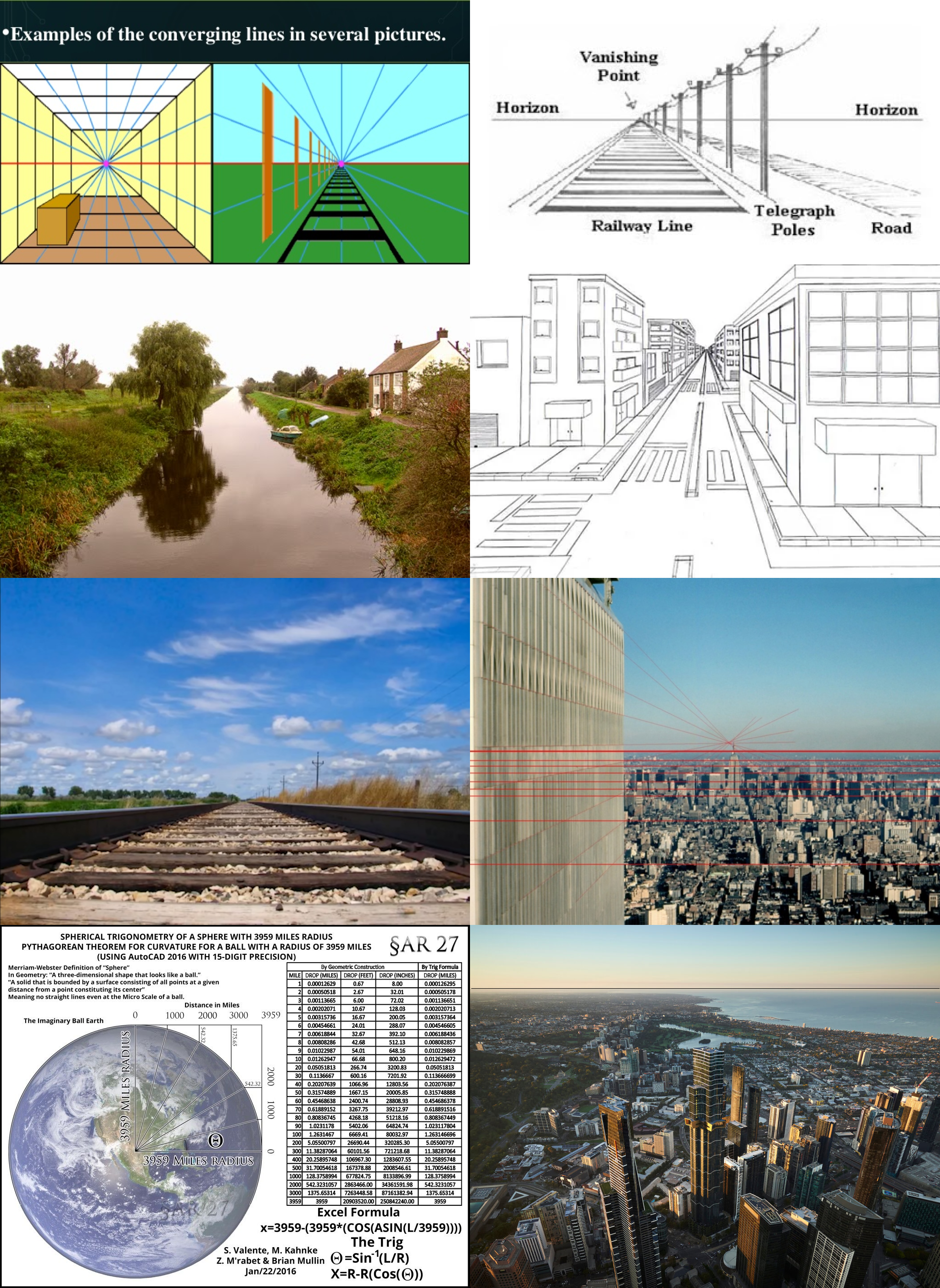
This is the evidence? Converging angles, masked in Hasbara-tier MS-Paint work?
It's fine if it is - I just need to know what you are considering evidence for your viewpoint. We can't properly reason about a topic if the topic isn't defined.
[ + ] GetFuckedCunt
[ - ] GetFuckedCunt [op] 0 points 10 monthsAug 6, 2024 21:19:45 ago (+0/-0)
None of it fits a spherical model. If we lived on a ball the horizon would be geometric BELOW eye level, with 8 inches of curvature per mile squared, at no point would the ball beneath our feet ever meet at eye level in the distance.
Converging angles is how our eyeballs take in the information of the world around us.
[ + ] aleleopathic
[ - ] aleleopathic -1 points 10 monthsAug 6, 2024 22:57:50 ago (+0/-1)
You've listed 3, and we can address them in order.
What about our vision suggests anything about the Earth's shape? What can you reason about geometrically that suggests a non-flat Earth? And finally, I am REALLY curious what you think may suggest a flat Earth, relating to astronomy.
But it is, and can be proven to fall away the further you go in elevation. I don't mean proven by experts either, you can prove this to yourself, much as the camera-zooming experiment you refuse to perform.
I love it when they trot this out, then forget that you will never be able to register this visually without instrumentation. Topographic variation is far higher over land, wave height is far higher over water, and, curiously, when you adjust for elevation (either through using a barometer, or, more accurately, radar against groundwater level), you actually prove the curvature. The Flat Earther's famously proved that themselves in front of Netflix' cameras in 2018. Ask if you can't find the cite on your own.
[ + ] GetFuckedCunt
[ - ] GetFuckedCunt [op] 0 points 10 monthsAug 7, 2024 04:10:15 ago (+0/-0)
Check my post history?
The Flat plane is Euclidean geometry, we have used euclidean geometry for thousands of years. Spherical geometry didn't exist until the jew Einstein came along and provided nonsensical theories to help postulate the globetard model.
Astronomy only work with a flate plane and the sun, moon and stars circling around us at the north pole. The globetard theory with all of the supposed orbital patterns makes absolutely no sense at all.
Incorrect, the horizon always rises to eye level even as high up as 120,000 ft in altitude. There isn't any single proof of the horizon dropping with elevation until you get to photoshopped images from NASA.
Well go ahead and showcase it with instrumentation, it's never been done. There is no 8 inches of curve per mile squared.
topography disproves the theory of a spherical earth, there can not be any changes in landmass to constitute a perfect sphere as NASA always showcases.
Curiously as well I've noticed you haven't provided a single link, image or pdf. You're making up claims without any receipts.
[ + ] jsac
[ - ] jsac 0 points 10 monthsAug 6, 2024 08:48:12 ago (+0/-0)
[ + ] con77
[ - ] con77 0 points 10 monthsAug 6, 2024 05:53:50 ago (+2/-2)
Some of us do it on a motorcycle
[ + ] GetFuckedCunt
[ - ] GetFuckedCunt [op] 0 points 10 monthsAug 6, 2024 05:59:18 ago (+3/-3)
We are at the centre of creation. Earth was created for us and the sun, moon and stars above us help us keep track of the time, navigate our plane and instills a sense of purpose.